
The Flow Country, Sutherland and Wester Ross: a photo journey
The Flow Country, Sutherland and Wester Ross: a photo journey

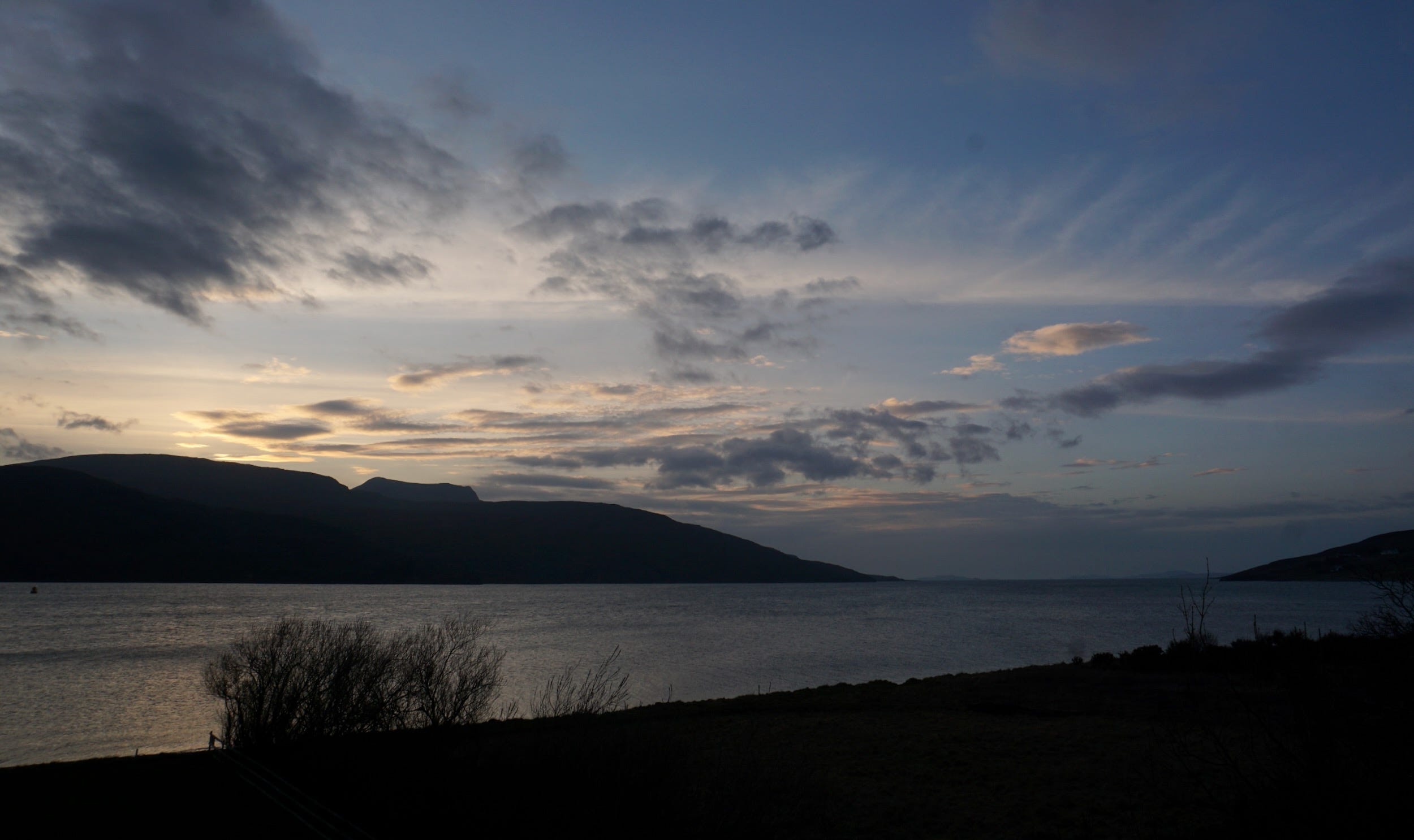
Early March, I’m back in Ullapool and there’s rain then sun then cloud. Oystercatchers chatter on the shoreline, cormorants skim the surface. The bookshops are open. The ferry from Stornoway arrives and leaves again on schedule.
On this visit, I’m not only back in familiar haunts but heading, too, to some new places, not least the Flow Country. But first, I head off on a walk, also new to me, passing An Teallach and towards Beinn Dearg Mór and Beinn a' Chlaidheimh (though I’m looking up at them not climbing them).
The walk guide says to park in the Corrie Hallie layby, walk up a lane and through a gate. But it doesn’t mention the warning sign on the gate of a bull and cows with calves – who are there gazing at me as they stand across and around the path. I pause for a while, then decide I can skirt round them up a rise to the left, and soon I’m on my way up gleann Chaorachain, An Teallach to my right wreathed in clouds, a burn rushing down way below me as the path climbs.
It's grey but not wet, occasional bright sun rays glint over or through a cloud – and, after meeting two guys coming back from a night at the Shenavall bothy, I see no one all day. The glen brings me out to wide, high moorland, mountains in most directions, down to my left the small, Loch Coire Chaorachain.
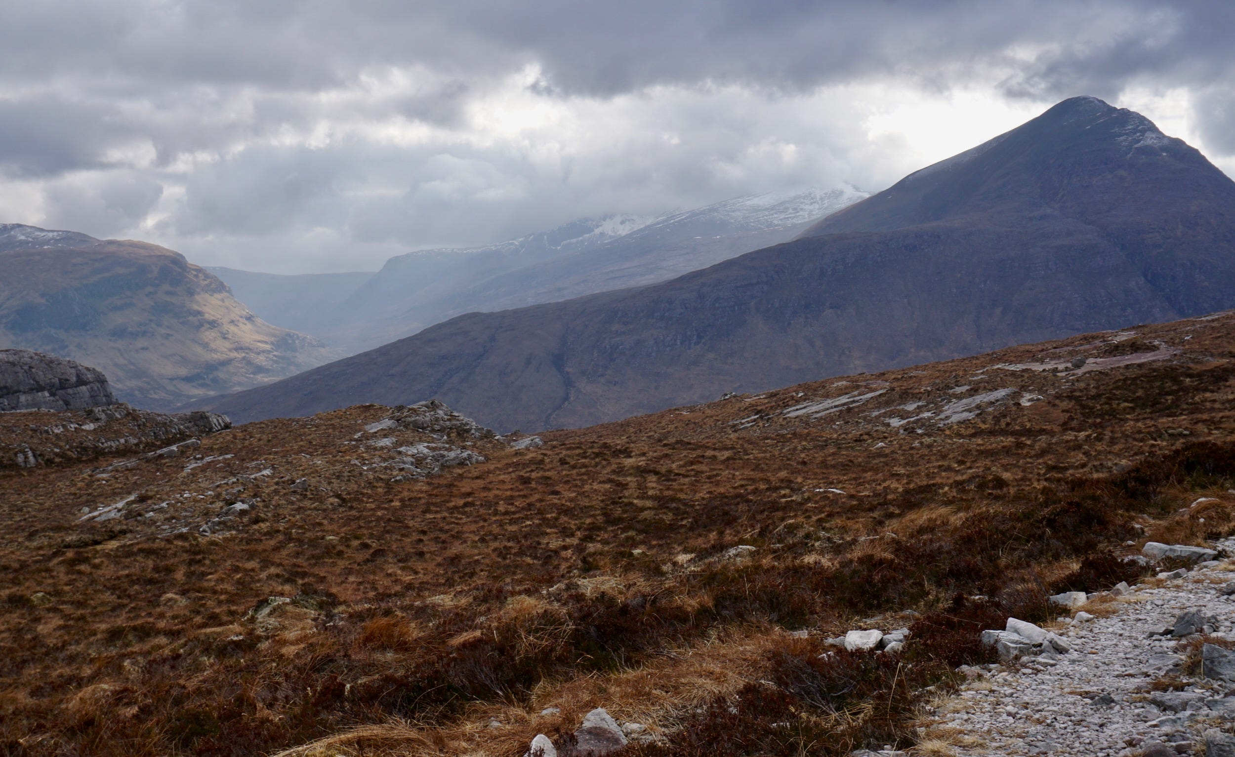
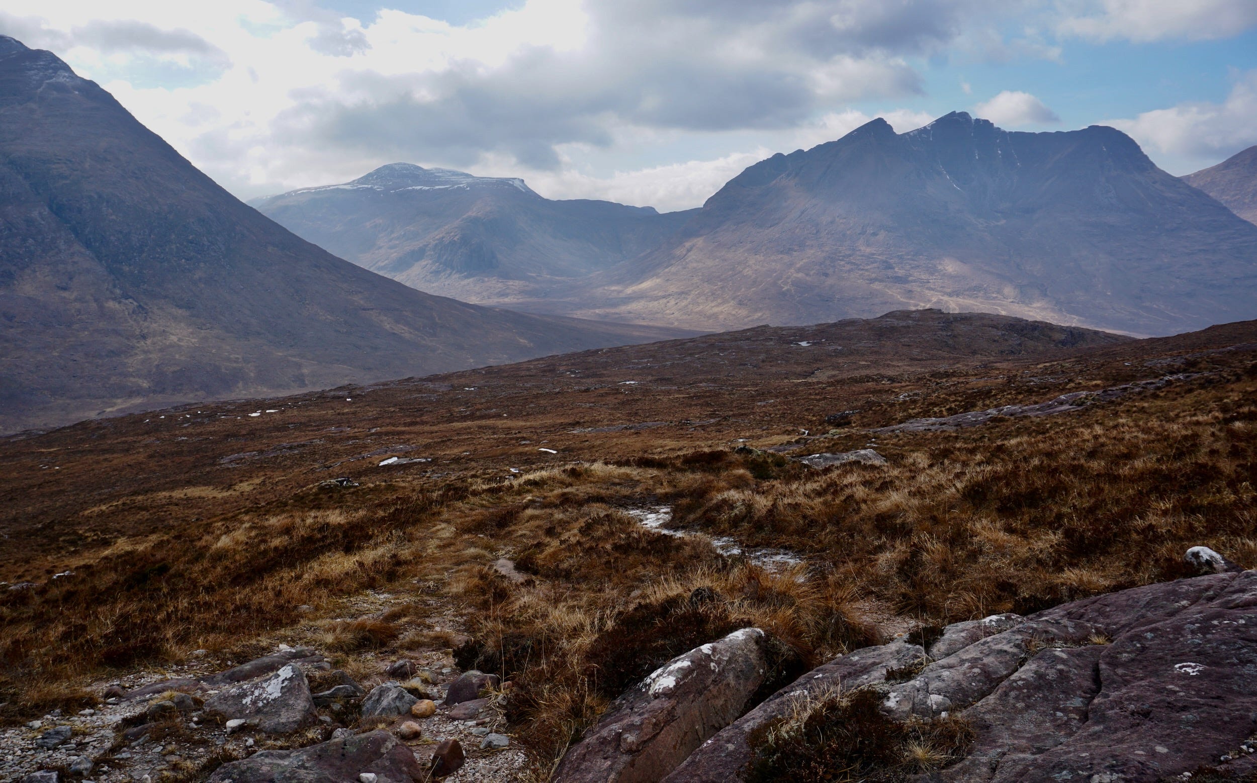
I finally stop after a couple of hours above the bothy with brilliant views down to Loch na Sealga. The sky has cleared a bit, there’s blue sky for a while over Beinn Dearg Mór. To be in such wild and beautiful nature and be alone feels like a real gift.
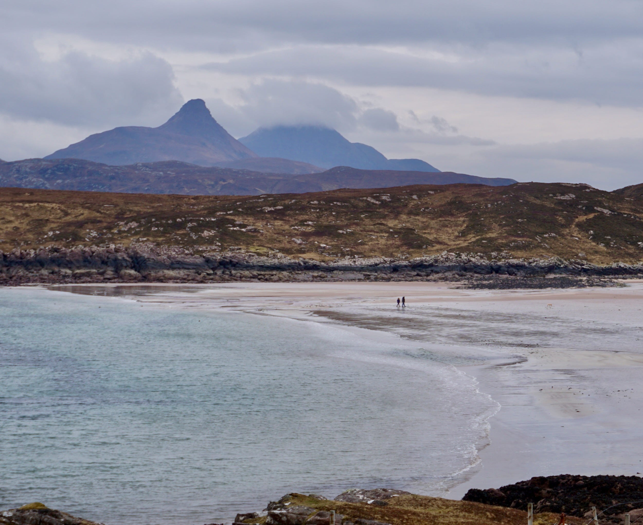
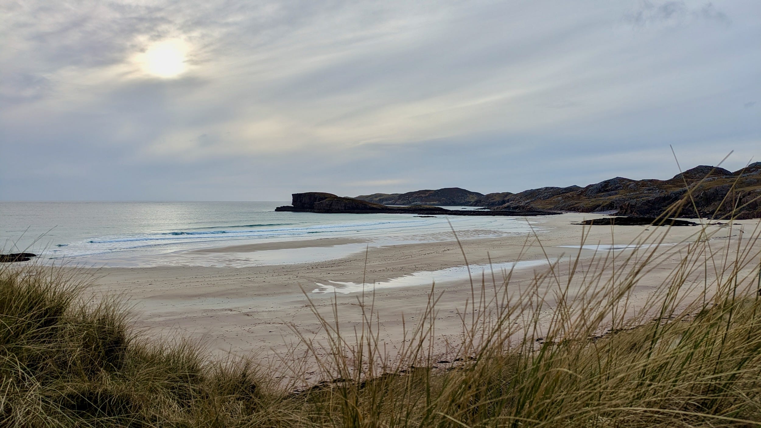
The following day, I visit more familiar haunts, up to Coigach, and a walk at low tide on Achnahaird beach, ringed with mountains and its pink-red sands, always so evocative. As I leave, I spot a couple of seals, their heads dipping in and out of the water.
Then, the next day, I’m heading to the Flow Country. It’s “the most intact and extensive blanket bog system in the world”, says the Flow Country Partnership. They hope to succeed, this summer, in their application for world heritage status for the area. Stretching across vast areas of Sutherland and Caithness, the peat and bog pools are both a haven for wildlife and an extraordinary carbon store. The around 400 million tonnes of carbon stored in the peat bogs is over double that stored in Britain’s trees. This makes it vital the flow country is maintained and restored.
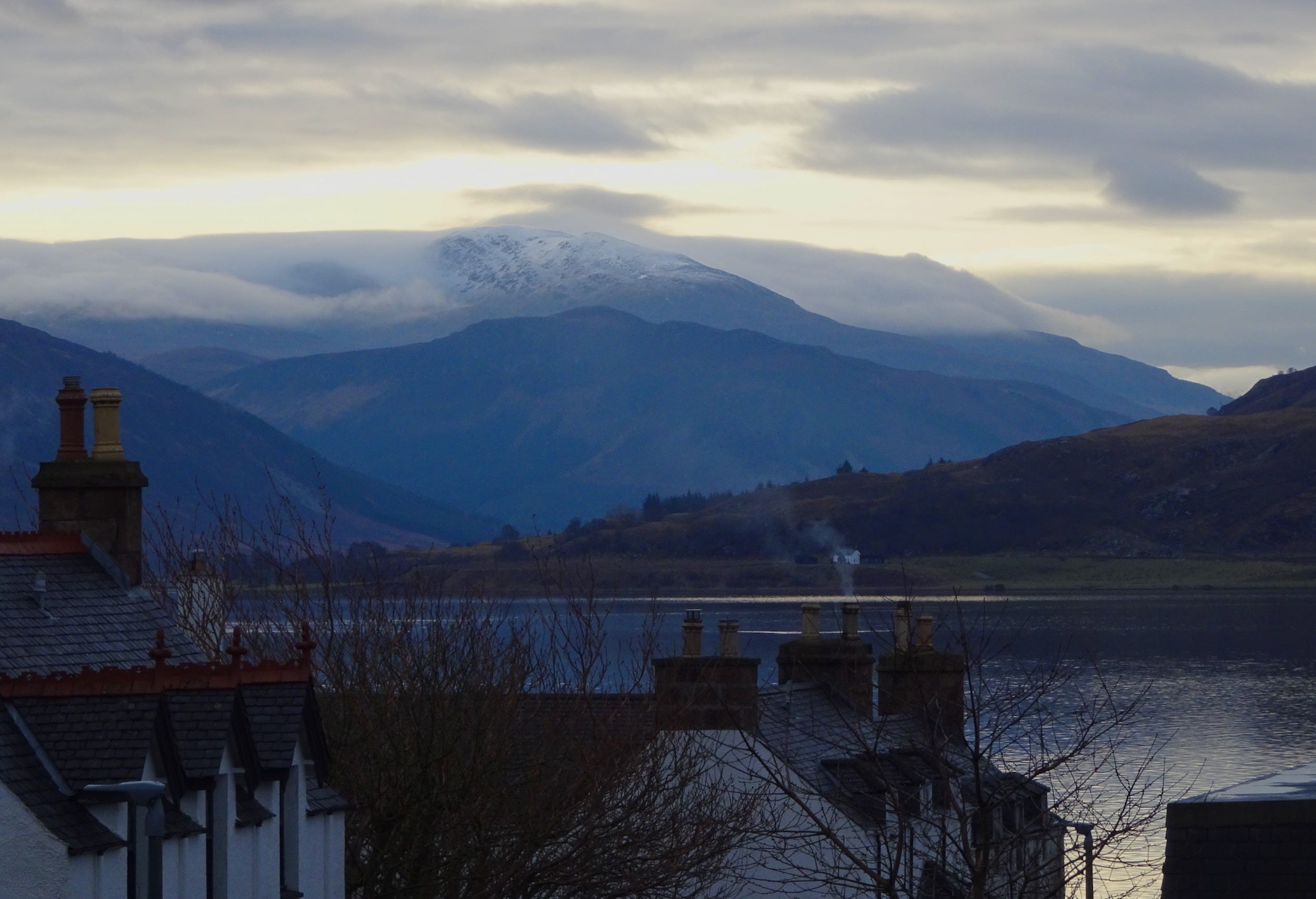
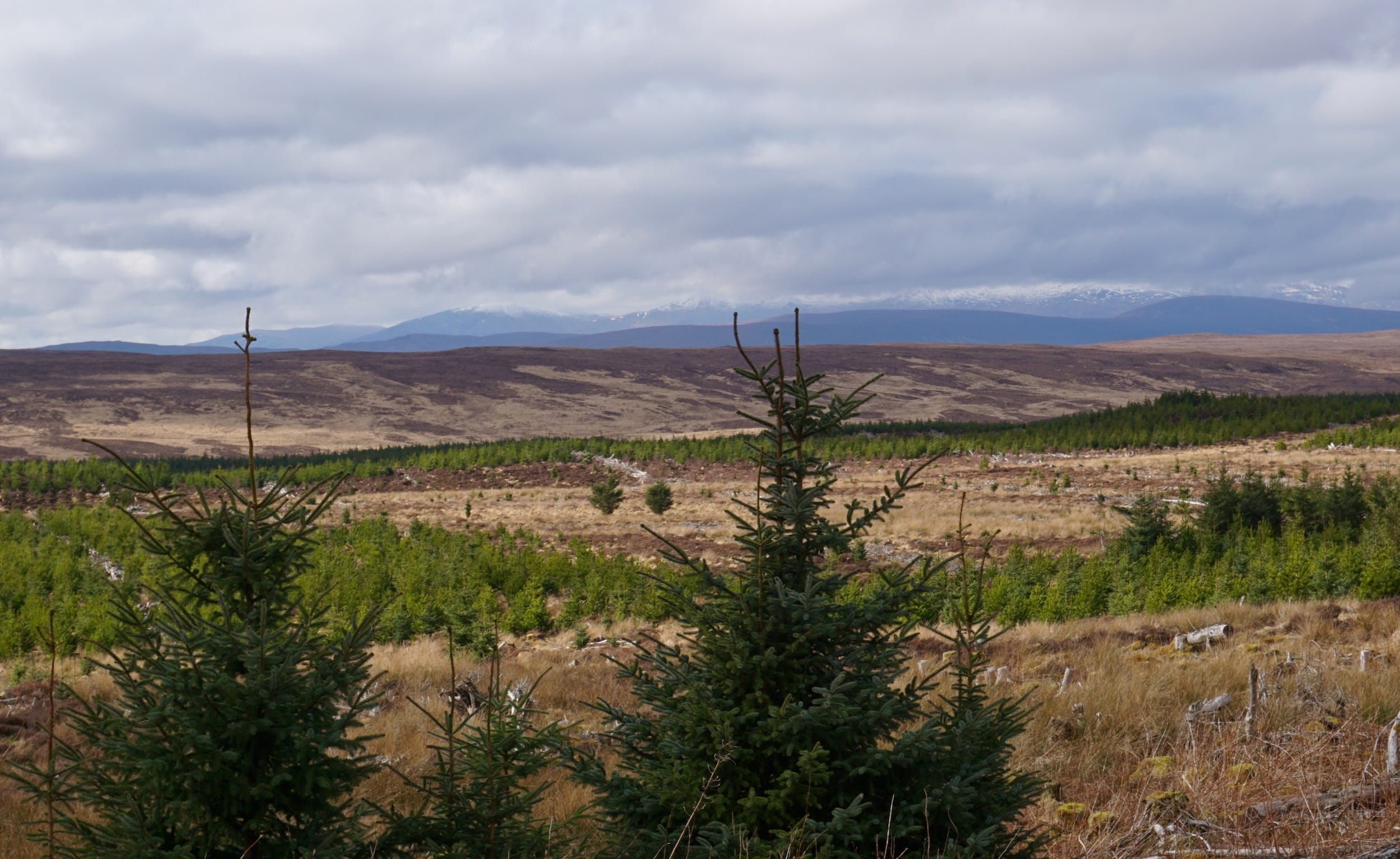
I ask myself if seeing a large, flat bog in early March, however vital in climate and biodiversity terms, will be as extraordinary as I imagine. But as I drive from Lairg towards Altnaharra, not yet Flow Country, I find myself on a long, straight single track road, through broad Strath Vagastie, open country, pine trees, distant mountains – something akin I imagine to northern Canada – and I’m already wondering how I’ve not been here before.
There’s only a few vehicles on the road, mostly vans, and the occasional lorry carrying timber. I stop in Altnaharra. It’s quiet, no-one around but I push at the hotel door, it’s open, and ask for a coffee. A friendly man sticks his head out of the kitchen and says it’s too early but then, as I leave, takes pity on me and soon I’m in a grand 19th century sitting room having coffee, biscuits and a conversation about the state of the world.

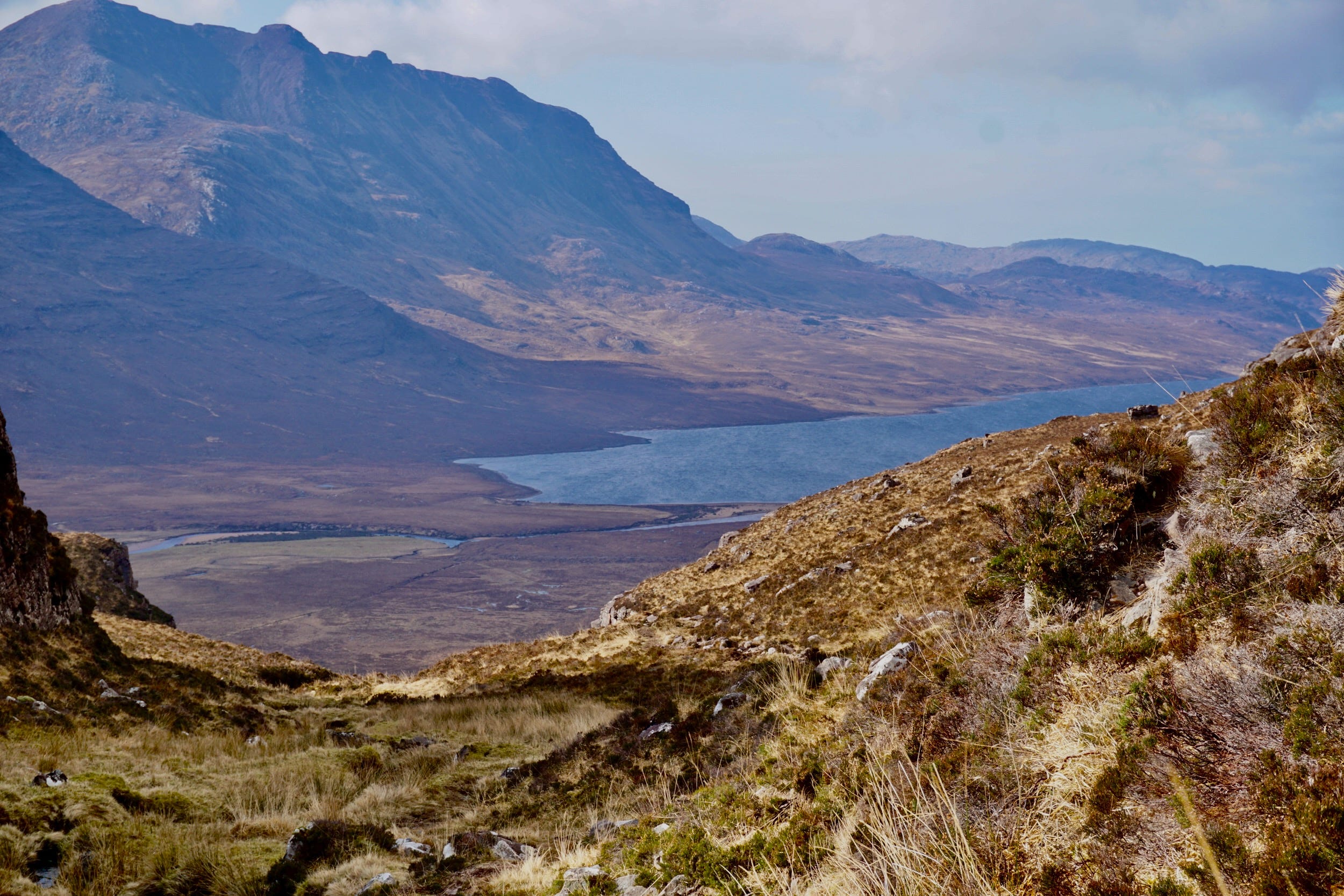
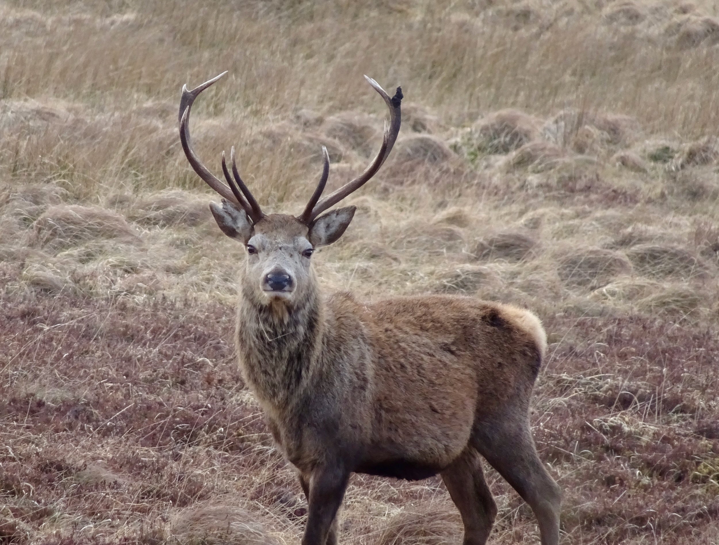
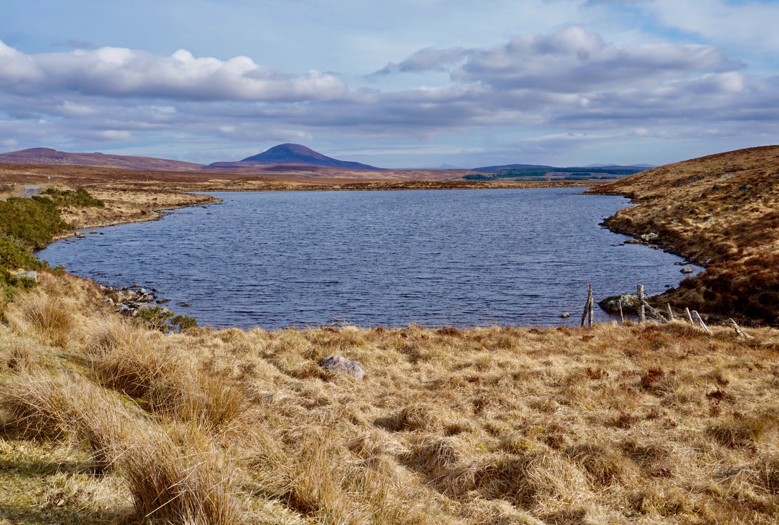
I head on into the Flow Country, north-east towards Syre, along Loch Navar, the snowy heights of Ben Klibreck looming grandly on the far side, then south-east down to Kinbrace. I see more deer than people as I pass Garvault House (officially, the British mainland’s most remote hotel).
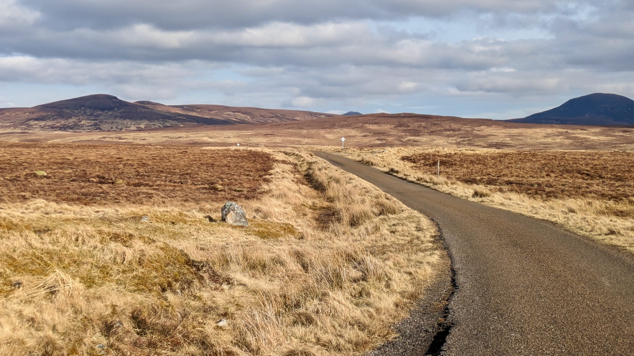
The landscape is wide open, yellowish-brown in colour, a few pine trees, some hills and mountains near and far, small lochans, the occasional sheep.
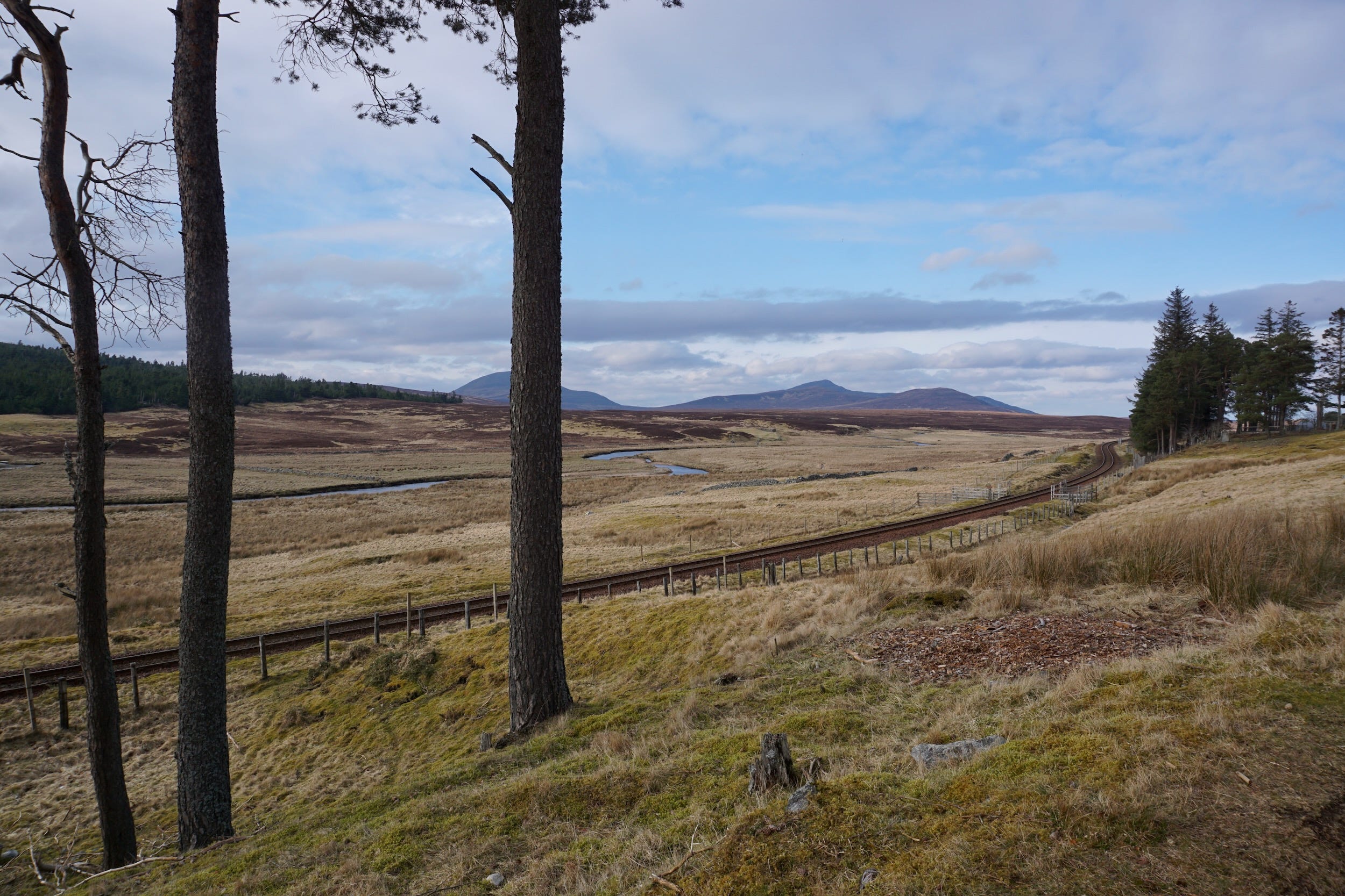
Kinbrace is small but there’s a few people around, and a train station, and then the road and railway line head north together towards my destination of Forsinard.
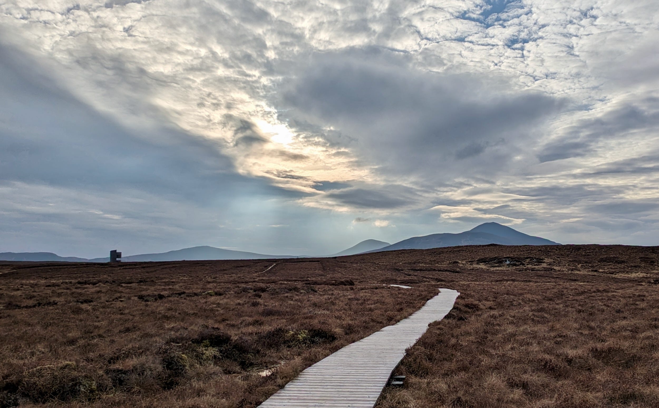
In Forsinard, the Royal Society for the Protection of Birds (RSPB) has a nature reserve, Forsinard Flows, with a path through the peat bog to a viewing tower. There’s some distant mountains, hazy in the evening sun going down behind them, a few trees, a landscape that seems to gently rise and fall, not quite flat. There’s just a couple of other people also walking to the viewing tower, lots of bird chatter.
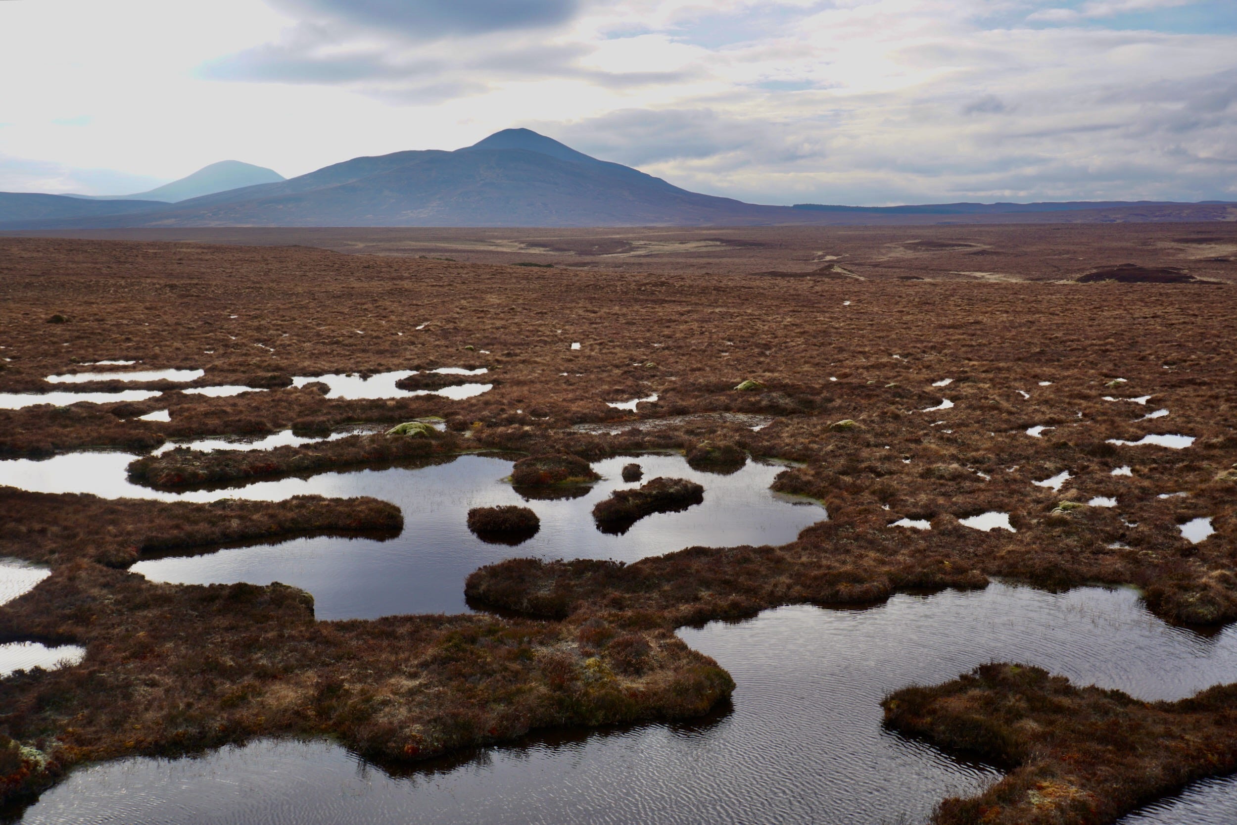
The peat bog is a browny-red-yellow colour, the endless smaller and larger pools brimming with plants, varying in colour. It stretches away in all directions, an open, deep beauty to it.
The small train station is home to a RSPB centre with information on the Flow Country. Their displays explain how a range of organisations including the RSPB Scotland and the Forestry Commission Scotland are working together to restore peatland, harvesting trees and blocking forestry ditches to allow the bog proper to come back. Scotland, I learn, has 15% of the world’s blanket bog, and one fifth of that is in the Flow Country.
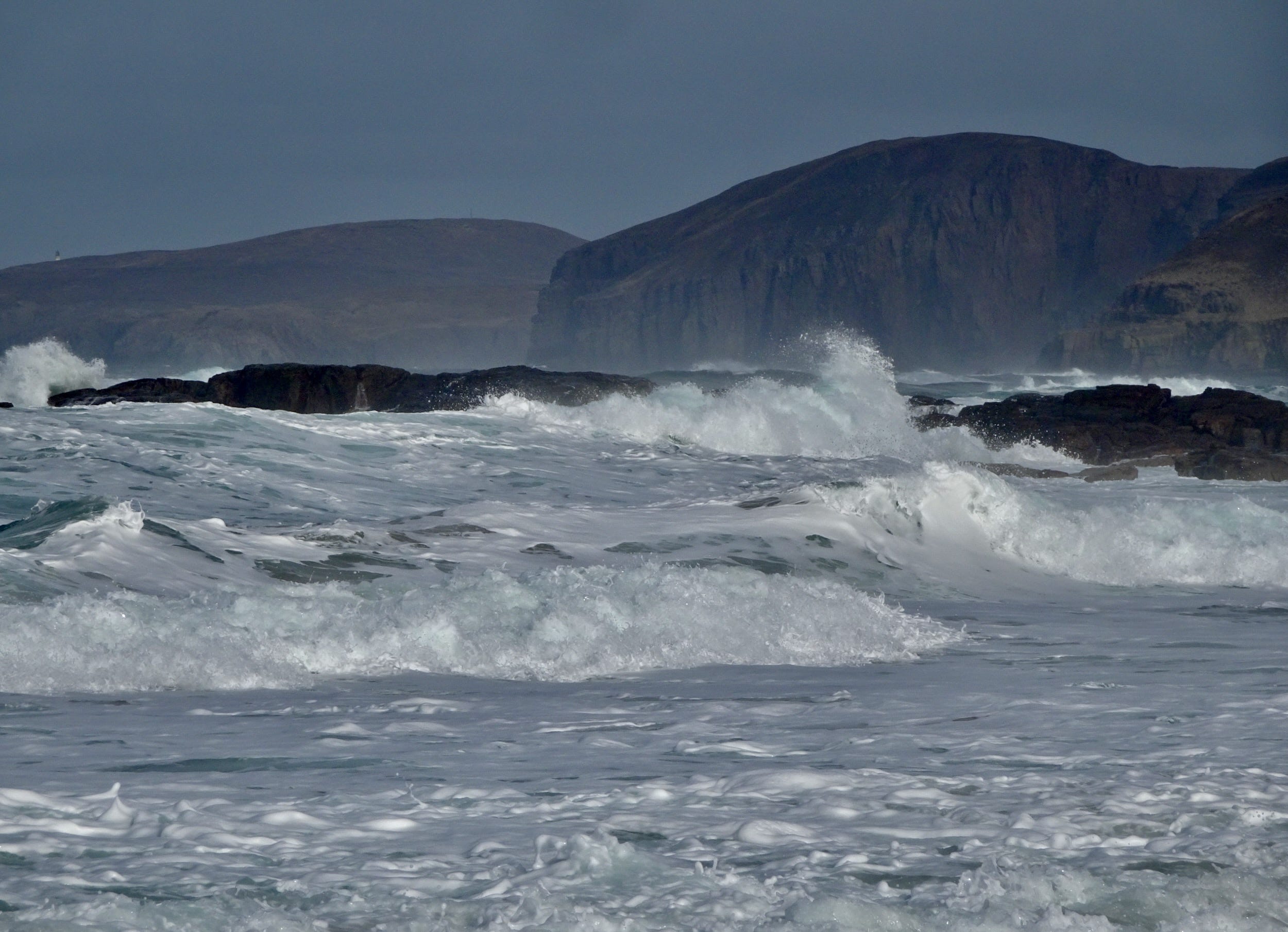
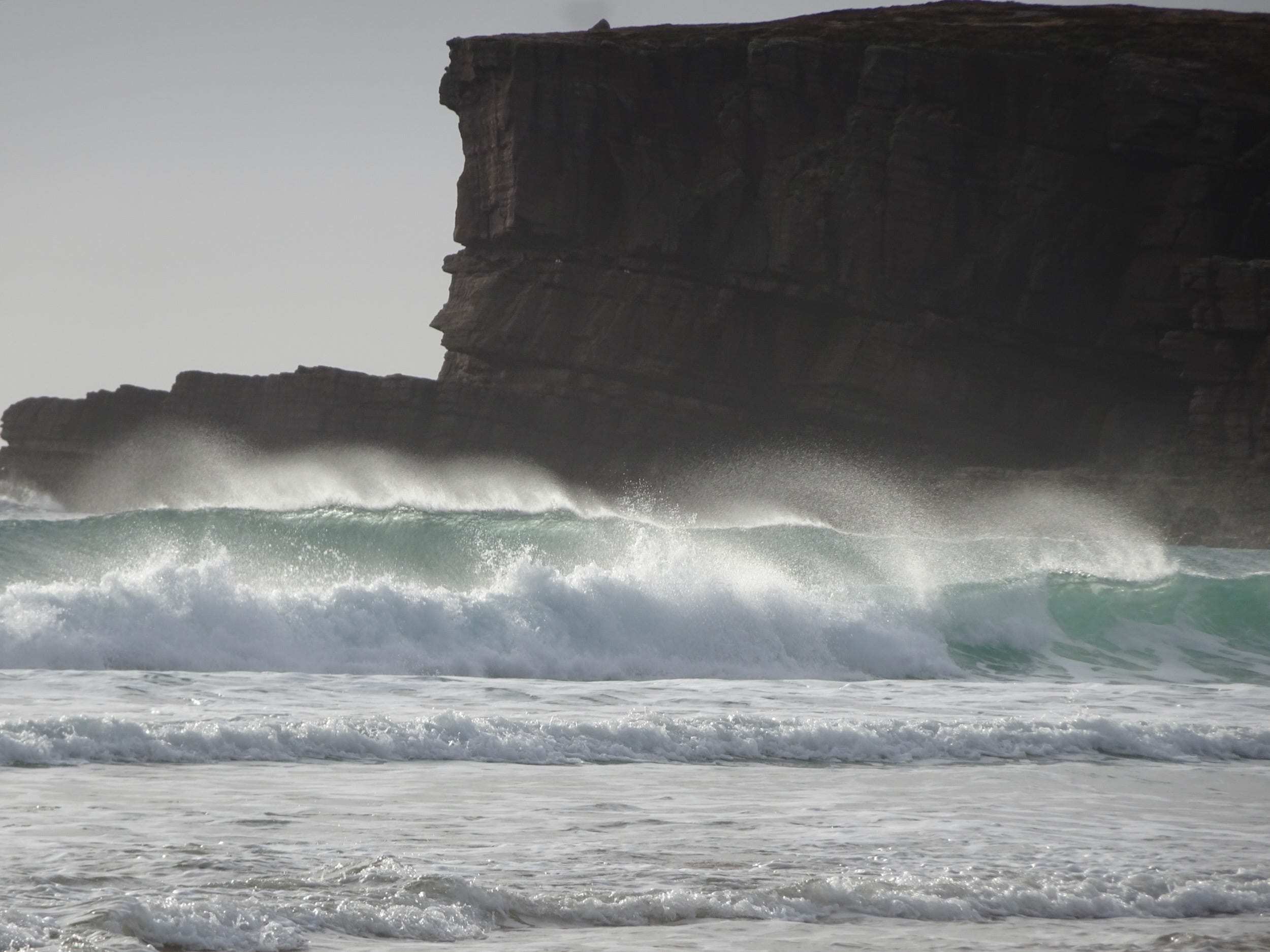
The next morning, I head north, through Strath Halladale towards Melvich, brighter weather driven by a 60 mile-an-hour wind. I’m soon at the north coast, with glimpses, through the bright haze, of Orkney in the distance. I walk to Strathy Point lighthouse, the sea is wild and bright, a view to the west of cliffs and stormy seas almost as far as Cape Wrath, the strong wind amazingly energising. I chat to someone who’s bought one of the flats at the lighthouse, his dad helping him out with some painting – what a place to live.
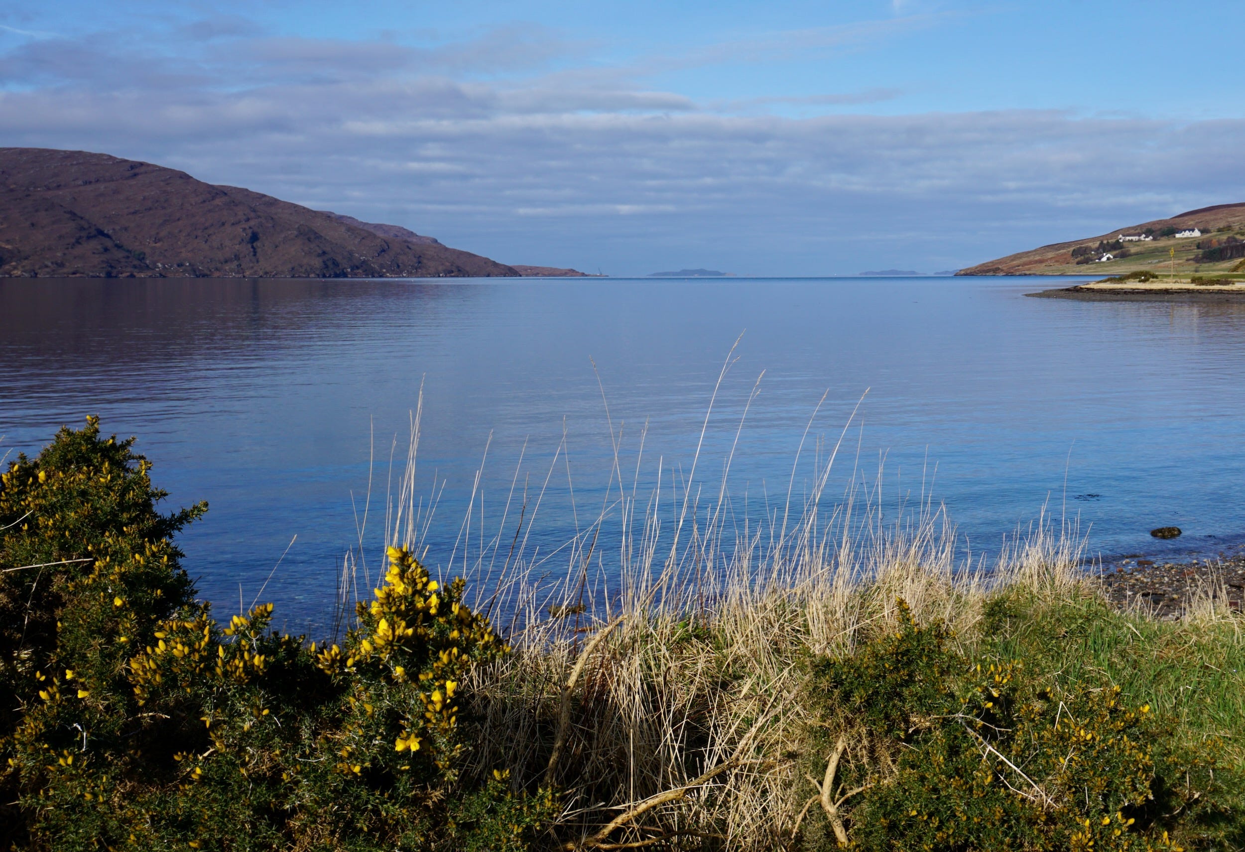
Heading west, a sign at Farr, just before Bettyhill, promises an open year-round bistro and café. Sure enough, down a narrow lane and round a corner, there’s a warm welcome at the Store, with fresh baking and coffee being enjoyed by plenty of locals – and soon me too. A bit further on, I take a detour at Tongue, down to Cnoc Craggie which gives a view over Loch Craggie, and further south to Loch Loyal, and over a wide landscape of mountains and peat bogs as far as the eye can see. Then a very blustery drive across Kyle of Tongue and on, slowly, through wind and rain to Durness. There’s a rainbow over the path down to Smoo’s Cave – but the rain droplets on my camera mean my photos have dark dots on them.
Further on, it’s low tide at Balnakeil beach – turquoise sea, huge wet sands. The high winds have kept people away and, after braving the sand shower driven by the wind, and taking some photos, I decide my camera probably doesn’t need a sand bath and retreat too.
I’m staying 11 miles south in a small place, Shegra, at the end of the single track road beyond Kinlochbervie. I’ve driven past here many times but never walked to Sandwood Bay, so staying here leaves me with no excuse.
In the morning, the weather’s reasonable, and I head off across the moorland the four miles to the beach. When I get there, just past high tide, the waves pounding in after the high winds of the day before, I’m the only person there – until one man catches up with me half an hour later.
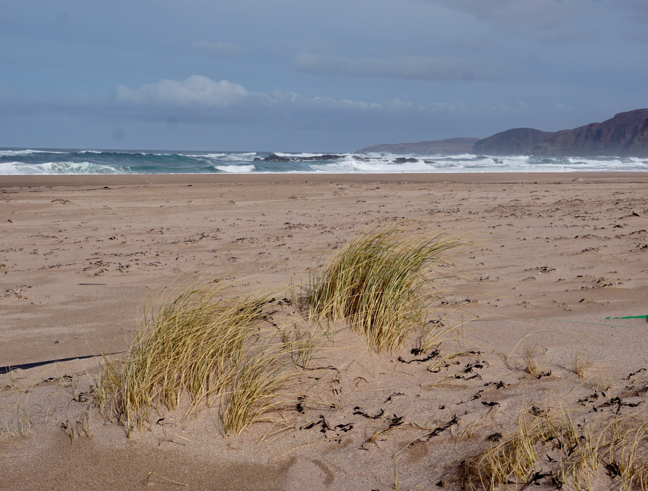
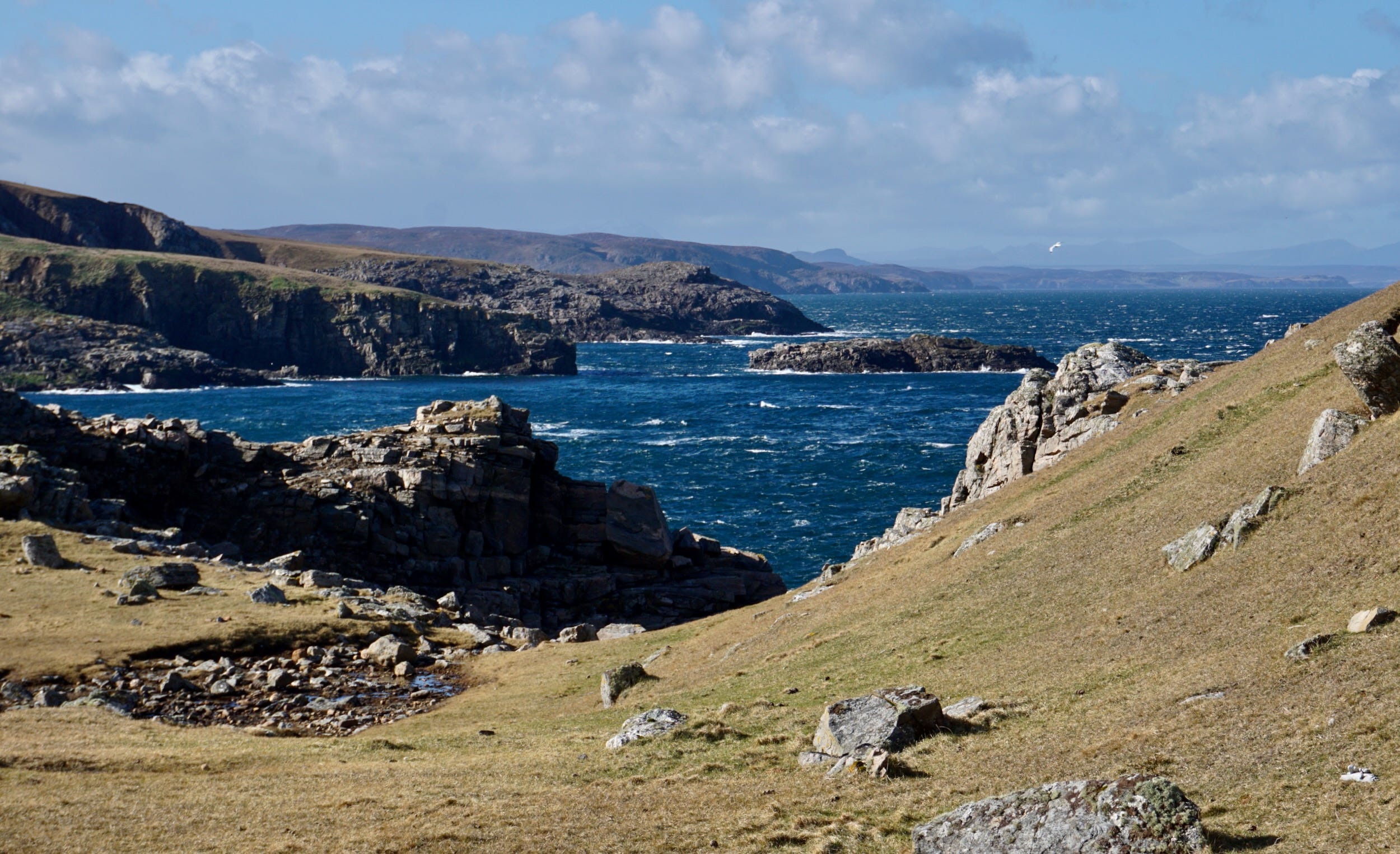
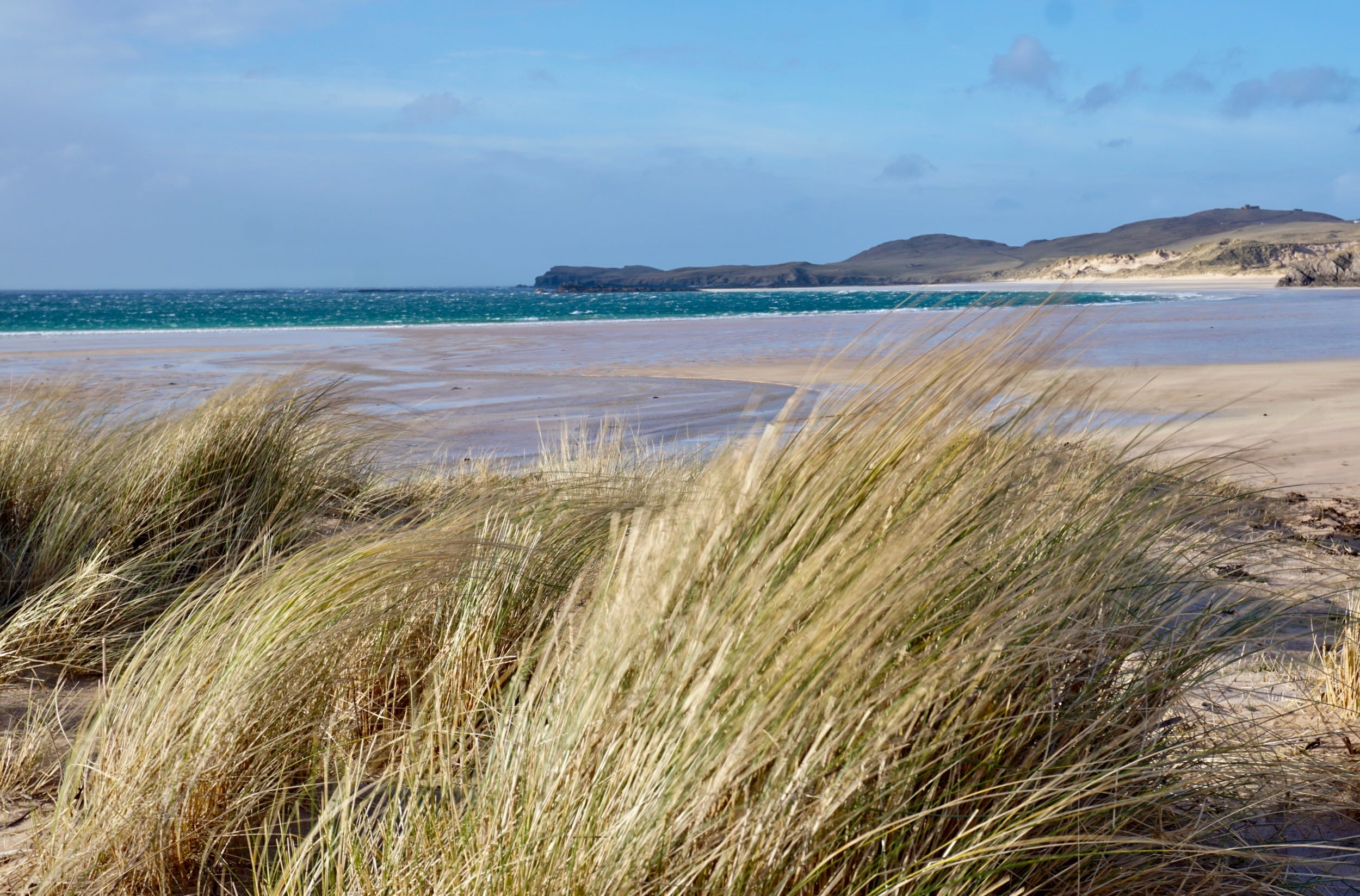
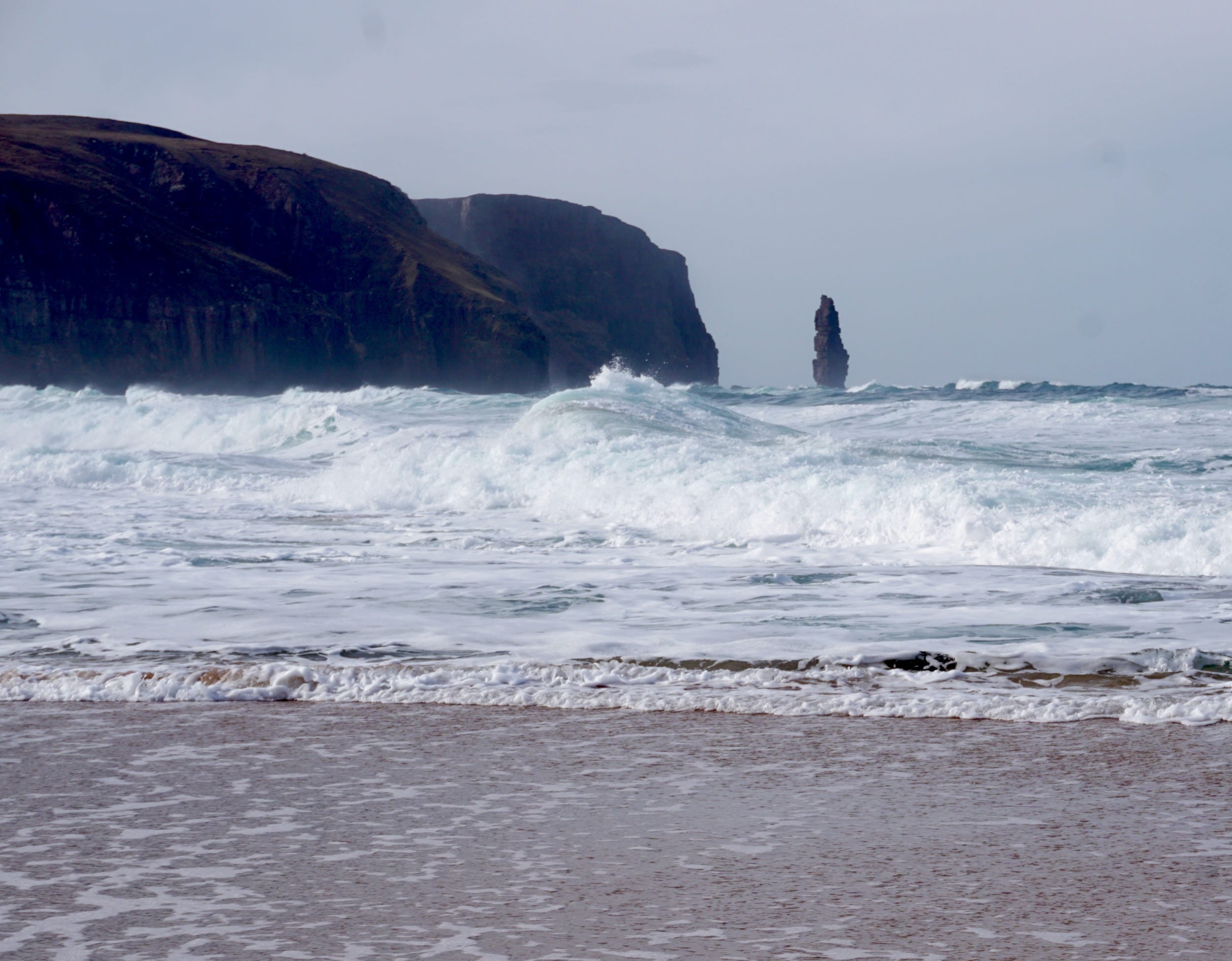
The mile-long stretch of reddish-yellow beach stretches in both directions, dunes and machair at its back, the seastack Am Buachaille – the Herdsman – at the southern end. The waves crash over red-black rocks near the water’s edge. It’s an amazing place. I’m glad I finally made it.
A coffee and cake at Kinlochbervie harbour is very welcome before I head off for a quick glimpse of Oldshoremore bay in the evening sun.
It’s another beautiful, wide beach with dramatic cliffs and a view westwards. I chat to a man who is disentangling plastic from seaweed. He says once they collect a tonne they take it down to Ullapool – it’s almost all from fishing gear, he says, musing that perhaps they should take it all to Holyrood or Westminster to have an impact.
The next day, the rain sets in, and I’m heading home. I stop for coffee at Kylesku, once again I’m too early – this time at the Klyesku hotel – and once again, I’m allowed in anyway. I turn, rather reluctantly, south but I will return.